
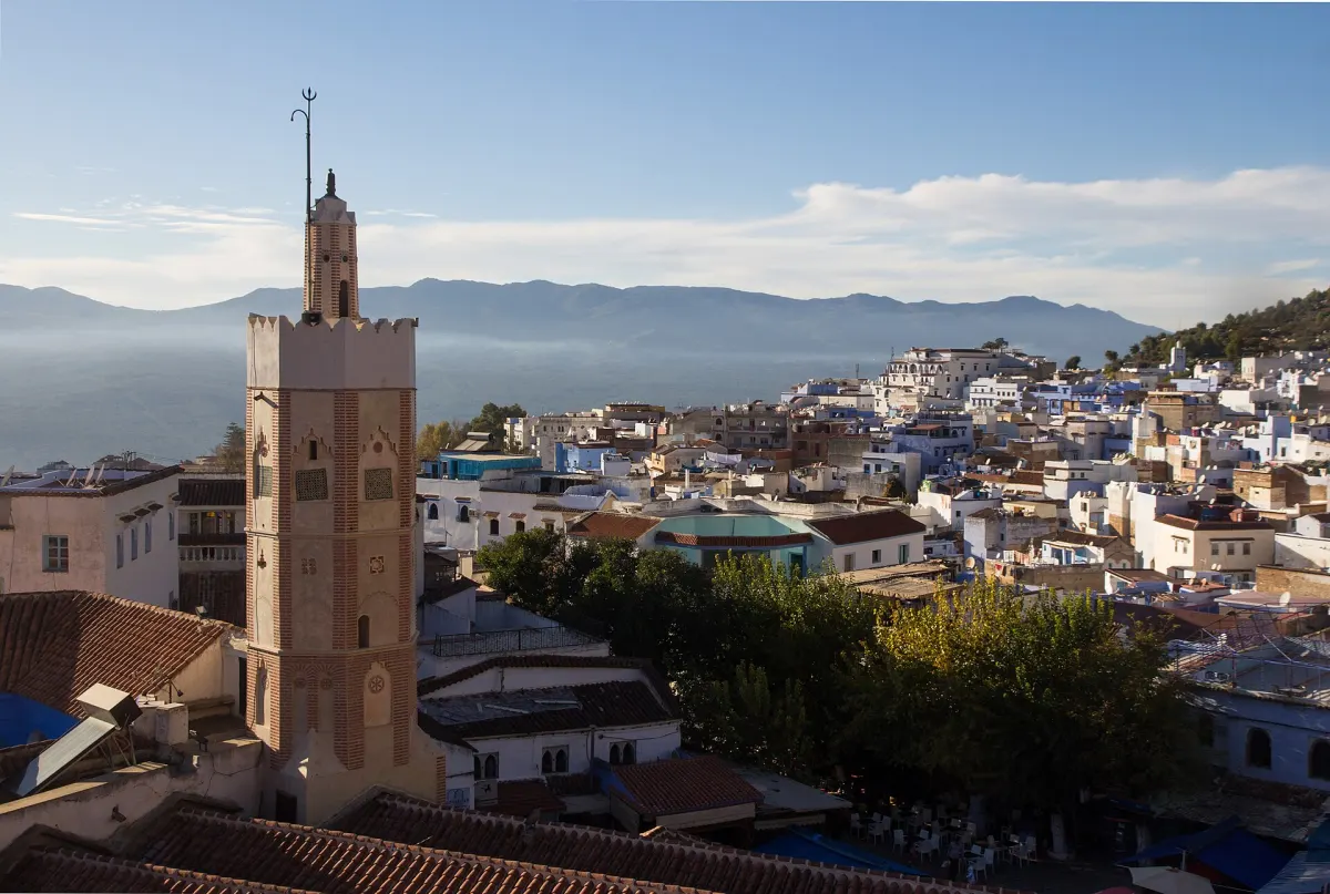
Chefchaouen takes its name from the two peaks above it, and you understand why on the way in: the town is not on the mountain, it is in it, folded into a crease of the western Rif just above 600 m. You do not drive to Chefchaouen, you drive up into it, and the last forty minutes of the approach are the part you remember.
The drive up
Four roads bring you here, and they are not interchangeable.
From Tangier it is the N2: east along the coast to Tetouan, then south-east as the land folds up. The Tangier–Tetouan stretch is dual carriageway and takes about an hour; past the Tetouan ring road the N2 becomes an ordinary two-lane mountain road and the work begins. Around 115 km in total, two to two and a half hours from the centre of Tangier.
From Tetouan it is the same road for a little under 60 km — the shortest of the four approaches and the one to use if you are already in the north. An hour, an hour and a quarter.
From Fes it is north-west through Ouezzane, about 195 km and three and a half to four hours. This is the long climb: the road leaves the plain, and the last hour is switchbacks.
From Rabat you take the A1 autoroute north to Kenitra, then continue towards Ouezzane, picking up the N13 for the last leg into Chefchaouen — roughly 250 km, four to four and a half hours. The autoroute is tolled; everything after Kenitra is not.
| Departure point | Road | Distance | Drive time |
|---|---|---|---|
| Tangier | N2 via Tetouan | ~115 km | 2h–2h30 |
| Tetouan | N2 | ~60 km | 1h–1h15 |
| Fes | via Ouezzane | ~195 km | 3h30–4h |
| Rabat | A1 via Kenitra, then N13 from Ouezzane to Chefchaouen | ~250 km | 4h–4h30 |
Distances are approximate and the times assume no stops and a clear road.
The drive earns its keep in the last half-hour, whichever way you come: the road stops following the valley floor and starts climbing, and the town appears all at once in its fold with the two horns above it. Coming up from Ouezzane, the view back over the Gharb plain runs fifty kilometres on a clear day. If you are only passing through towards Akchour or the coast, a signed bypass road loops around the town instead of dragging you through its edge.
Parking at the edge
The medina is pedestrian, and it is built on a slope. Those two facts together are what make arrival the hardest part of the trip, not driving.
Bab El Ain and Bab Souk are the two gates the road actually reaches, one at the top of the town near the kasbah, one by the market on the lower side. Both have parking next to them, though neither is a car park in the northern-European sense: a strip of tarmac, a walled yard, or flat ground with a man in a chair who will look after the car for a few tens of dirhams, paid in cash. 10–20 MAD a night is the band to expect. Take the ticket if there is one and leave nothing visible inside.
Ask your guesthouse in advance which gate is nearest: the two are on opposite sides of the medina, and the walk from the wrong one is twenty minutes of stairs with your bags. The alleys are stepped or steeply ramped, and a roller suitcase that was fine at the airport is dead weight within a hundred metres. Bring one soft bag, or ask the guesthouse to meet you with a handcart — most small places do this as a matter of course.
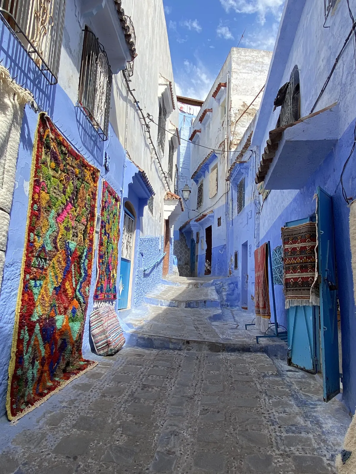
A large vehicle is a handicap here. The lanes serving the gates are narrow, the parking strips tight, and a big car will circle a space a small one takes. A compact hatchback or small saloon is the right car for this town and for the mountain roads around it.
What the car unlocks
The bus reaches Chefchaouen. It does not reach the things around it, and they are half the reason to come.
Akchour, 28–30 km out and about 45 minutes away on a winding mountain road signposted Route d’Akchour, is the main one. Two walks start there. The Pont de Dieu, God’s Bridge, is a natural rock arch spanning the river: figure 1h30 to 2h each way, depending on how much you stop. The Grand Cascade is further, 2h to 2h30 each way. There is no bus, and grand taxis run from the rank by the bus station on Avenue Maghreb Arabi at 25–30 MAD a seat, leaving when full and returning when full — fine until the afternoon you are the only one who wants to go back.
The Akchour road runs into the Talassemtane National Park, created in October 2004 and covering 58,950 hectares of the central Rif. It exists mainly for one tree: the Moroccan fir, Abies maroccana, which grows here and almost nowhere else. In practice the park is where the tarmac ends and the trails begin, and a car means choosing your trailhead rather than accepting the one the taxi drops you at.
Oued Laou on the Mediterranean is about 50 km and an hour down the same valley: a fishing town, a beach, fish grilled at the port, and back before dark. Then the villages, which are the part a car makes possible and a bus makes pointless. The Talassemtane Women’s Cooperative sells textiles woven in the villages around the park, and the Ecomusée du parc national Talassemtane, on Rue Bouhanane in the medina, explains what you are driving through.
One caveat: the Akchour road is narrow, and on weekends half of northern Morocco seems to be on it. Leave early, and wear shoes rather than sandals — the path is loose stone and wet rock.
The medina on foot
Everything radiates from Outa el Hammam, the main square: the kasbah on one side, the Grand Mosque and the minaret of the photograph at the top of this page on another, cafés round the edge, a fountain in the middle. It is where you will eat, twice a day.
The kasbah is the walled compound the town’s founder built here in the fifteenth century — a small Andalusian-type garden, an ethnographic collection, and a tower you can climb for the rooftop view. The ticket is sold at the gate, so check the price there rather than trusting a number in a guide.
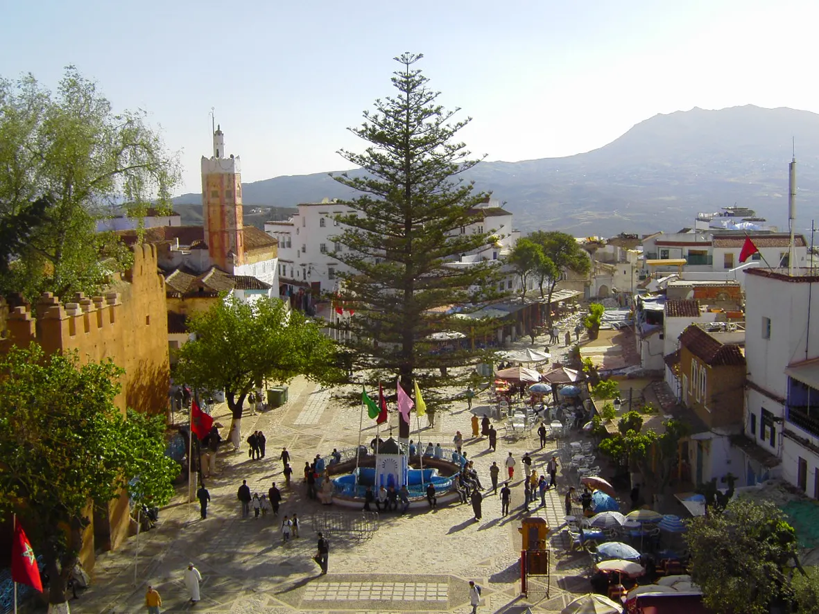
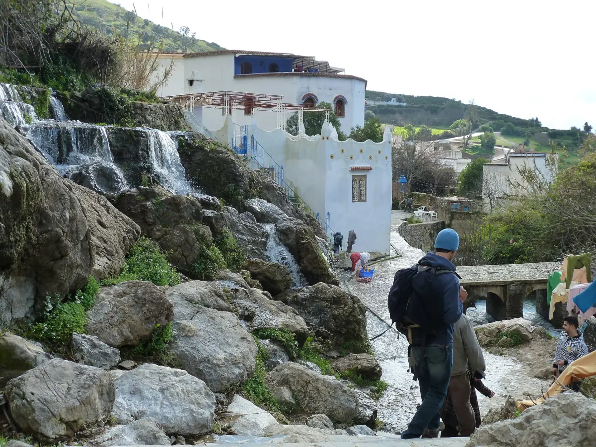
Ras El Maa is the spring at the top of the medina, where the water comes out of the hillside and is channelled down through the town. It is a working place rather than a monument: a small waterfall, a bridge, and laundry still done at the water’s edge. Follow the lane uphill past the square and keep going until the crowd thins.
For the view over the whole town you have two options: pay for the kasbah tower, which gives you the square and the rooftops immediately below, or walk up to the Spanish Mosque ridge, which gives you the town entire. The second is free and better.
The Spanish Mosque at sunset
The Mosquée Jemma Bouzafar — the Spanish Mosque to everyone who is not Moroccan — stands alone on the ridge above Ras El Maa, and it is the best hour you will spend in Chefchaouen.
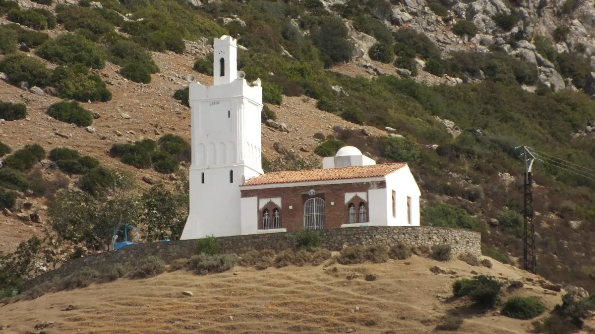
The walk is short and it is uphill: about a kilometre from Outa el Hammam, 1.6 km from the spring, twenty to thirty minutes at an easy pace. You cannot drive it — leave the car where it is.
Leave the square about an hour before sunset. In mid-September the sun sets around 19:25, and there is a clock change to know about: Morocco has kept UTC+1 year-round except during Ramadan — this year it ran on UTC+0 from 15 February to 22 March — and on 20 September 2026 it drops to UTC+0, where it stays, so the sunset that evening is around 18:20, an hour earlier than any guide printed before the change will tell you. Bring a torch for the descent; the path is loose rock and there are no lights on it.
What you get is the whole town below — the blue washed pale by the low light, the two horns dark above it, the Rif going soft and grey-blue into the distance. It is popular, and in season there will be fifty people on the ridge; the ridge is longer than the crowd, so walk three minutes along it and you will have a rock to yourself.
Light, and when to shoot
This is a town people photograph, and the light is why. The blue is strongest in the middle of the day, when the sun is high and the paint reads as paint; the alleys are deep and shaded, so a mid-morning frame gives you saturated walls, dark doorways, and one hard strip of sunlight across worn paving. Early morning and late evening are softer for the town as a whole, but the blue goes grey and stops being the subject.
The town empties twice a day, and both are useful. From roughly 13:00 to 15:00 most shops shut and the lanes clear — a good window for the wider views, a bad one for shopping. And on Friday everything closes for prayer around midday, and the medina belongs to residents until mid-afternoon. If you want an empty blue alley with the light still good, those are the hours; if you want the shops open, they are not.
Driving the Rif safely
The mountain roads here are perfectly drivable and they demand your attention the whole time.
Hairpins. The N2 south of town towards Bab Taza, and the Akchour road, will have you in second gear for long stretches. Blind bends are the norm, and the local habit is to swing wide and cut the apex, so expect a car or a moped on your side of the white line on a corner you cannot see around.
Fog. The Rif catches cloud, and from autumn through spring the top of the road can be in mist thick enough to bring traffic to walking pace. Put your lights on and follow the white line rather than your instincts.
Secondary roads. The N2 and the N13 are sound and reasonably wide. The provincial roads — the RP and RR numbers — vary enormously: good tarmac, then good tarmac with a broken edge, then no tarmac. If the surface ends, so does your journey unless you have a 4x4 and daylight to spare.
At night, do not. Outside the towns there are no streetlights, no barriers on the outside of the bends, and a great deal of traffic that is not a car: mopeds without lights, donkeys, pedestrians in dark clothing. In winter the passes above the town, including the N2 towards Bab Taza, can close in heavy snow. Plan to arrive before dark.
Radar checks are common on the N2 and the N13, and the fine is paid on the spot in cash.
Practical notes
Fuel. In mid-September 2026 petrol was around 14.95 MAD a litre and diesel around 15.04 MAD — diesel, already the dearer of the two, rose again on 16 September. That inversion is not something Morocco has always had. Say gasoil if you want diesel; petrol into a diesel engine ends the trip. Fill up in Chefchaouen before heading for Akchour or the park: there is nothing on those roads you can count on, and rural stations keep short hours and often take cash only.
Overnight parking. Use the strips and yards at Bab El Ain or Bab Souk, pay the guardian in cash, and keep the ticket if you get one: 10–20 MAD a night is the going rate. Photograph the car, leave nothing visible inside, and do not hand over the keys to anyone offering to move it.
Crafts, and buying direct. The medina sells a great deal that came from elsewhere, and one thing is worth knowing about: argan oil is not a Rif product. The argan tree grows in the Souss, in the south-west, and what is on sale here arrived by van — not bad, but not local. What the town and its villages are for is wool: the heavy blankets and rugs in Jebala stripes and patterns, woven in the villages around the park and sold through cooperatives, including the Talassemtane Women’s Cooperative. Buying from a cooperative rather than a shop on the square keeps the money in the village that made the thing, usually at a better price for the same work.
Cash and signal. Bring cash: parking guardians, small cafés, rural fuel and the cooperatives are all easier in dirhams, and most ATMs are in the lower town rather than the medina. Download offline maps before you leave town.
Chefchaouen without a car is a postcard: a morning of blue alleys, a sunset on the ridge, and a bus out. With one, the town becomes the middle of a stay in the Rif rather than the whole of it — Akchour in the morning, the mosque at dusk, the coast before lunch. IVVER lists cars from professional providers, so the vehicle can be settled before you fly rather than negotiated in a car park at the gate.
Photographs: Chefchaouen from above by Alexey Komarov, CC BY 3.0; Ras el Maa by YoTuT from United States, CC BY 2.0. The alley, the square and the Spanish Mosque are CC0 or public domain and require no credit. The register of all image credits, with the Commons title and source page for each: /blog-media/CREDITS.md.